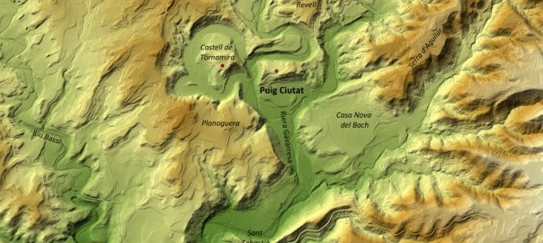
Puig Ciutat stands in a meander of the Gavarresa stream, which provides a natural defence along part of its perimeter but gives it little long-distance visibility. Occupation of this site, then, probably didn’t respond to the strategic advantages of this meander.
What did the inhabitants of Puig Ciutat defend or control? When was it destroyed? At the end of the Roman Republic? Where was it attacked from? What factions could assailants and besieged have belonged to?
As we’ve seen, some of these questions have now been answered thanks to the work carried out so far.
To solve these mysteries, the Puig Ciutat team is applying traditional archaeological exploration as well as geophysical archaeology or remote sensing over a large area surrounding the site.
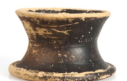
Inventory number: PC10-2005-3 Name of the object: pyx Material: ceramic Production: black burnish from Cales Type: common ware Shape: Lamb. 3 Dimensions: height: 4,8 cm. diametre: 8,7 cm Chronology: 125-25 BC Survey: july 2010 Provenance: Sector 2 Description: A small pyx with tapered edge and concave sides without a rim and with an annular foot. It has no decoration. For individual use for consuming liquids.
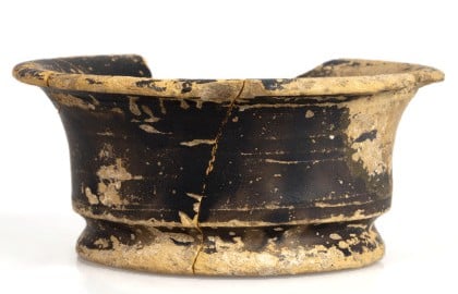
Inventory number: PC10-2005-4 Name of the object: small goblet or cup. Material: ceramic. Production: black burnish from Cales. Type: ware Shape: Lamb. 2 Dimensions: height: 4 cm. diametre: 9,7 cm. Chronology: 125-25 BC. Survey: july 2010. Provenance: sector 2. Description: Small goblet or tapering cup with concave sides and a marked inflection at the bottom. It shows no decoration. For individual use for consuming liquids.
The intervention at this point reveals the presence of one of the main entrances to the settlement in its last phase. The suspicion that it was here was based on the fact that a path to the top of the hill from the east converges here with the main street in the area, which runs north-south.
The work located two sections of wall at this point, separated by a certain difference in height between them, at the ends of which there could have been the gate. It wasn’t possible to confirm this as they have been largely flattened. Even so, this idea is backed up by the presence inside the settlement of a wall parallel to the city wall that forms an entrance passage leading to a second gate, which was found to be sealed.
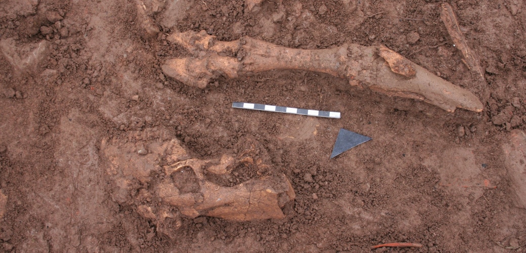
The structures preserved inside the settlement are totally unknown as the area was found covered by a thick layer of stones whose purpose could not be explained. The dating of the various associated articulated animal remains gave a date for it during the last occupation phase.
As a hypothesis, it was suggested that the layer of stones could have something to do with reinforcing the area or sealing it off in the settlement’s final moments, but we shall have to wait for future campaigns to be able to corroborate this.
Fill level from the Late Roman Republican Period
Decembre 2014.
Western part of the trench
Structures dated from the Late Roman Republican Period can be observed. Decembre 2014.
Part of the cranium and a bovid articulated limb
Decembre 2014.
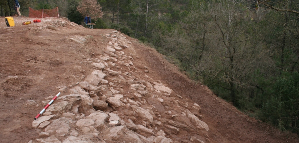
Sloping section of wall
Part of the wall and its ruins can be seen towards the slope. The wall running parallel to the city wall can be seen on the left, forming an entrance passageway. Decembre 2014.
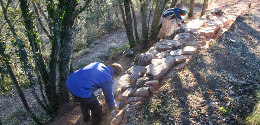
Section of city wall (north-east stretch)
Decembre 2014
[left]. Photogrammetric study at the end of the 2014 season. [right] Location of various excavated structures
At bottom left and top right, stretch of Late Republican city wall
Work on this point was carried out with the object of finding out all about the entire stretch of city wall already located and, at the same time, to see how the structure was laid down.
The work showed that the city wall was laid down directly over earlier strata. On this side it could be seen that the walls of the intermediate phase were visible under the Roman wall. A wall was also located belonging to the settlement’s oldest phase (Late Bronze/Early Iron). This is the earliest structure located for this period.
View of the Late Bronze/Early Iron Age structures outside the Late Republican city wall
Decembre 2014.
View of the Late Republican city wall from the north-east
Decembre 2014
[left]. Photogrammetric study and [right] drawing of the excavations at the end of the 2014 season
he outline of the Late Roman Republican city wall and the excavated structures can be clearly seen. Late Republican city wall and earlier structures located outside the area occupied by the Roman Republican settlement. Decembre 2014.
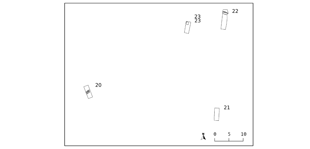
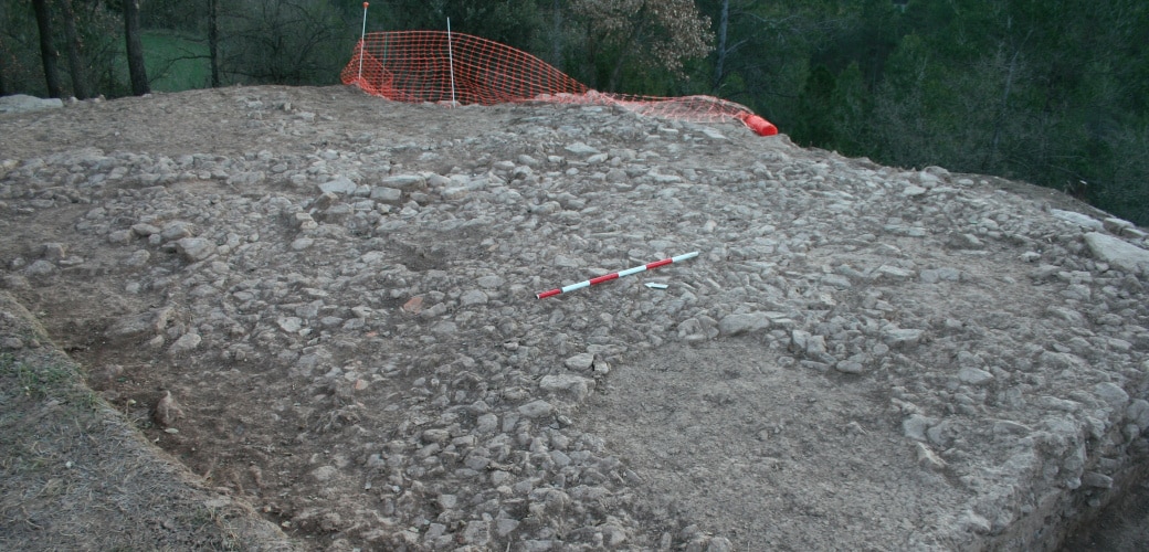
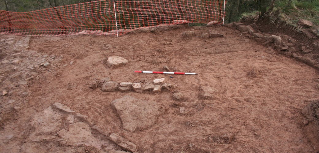
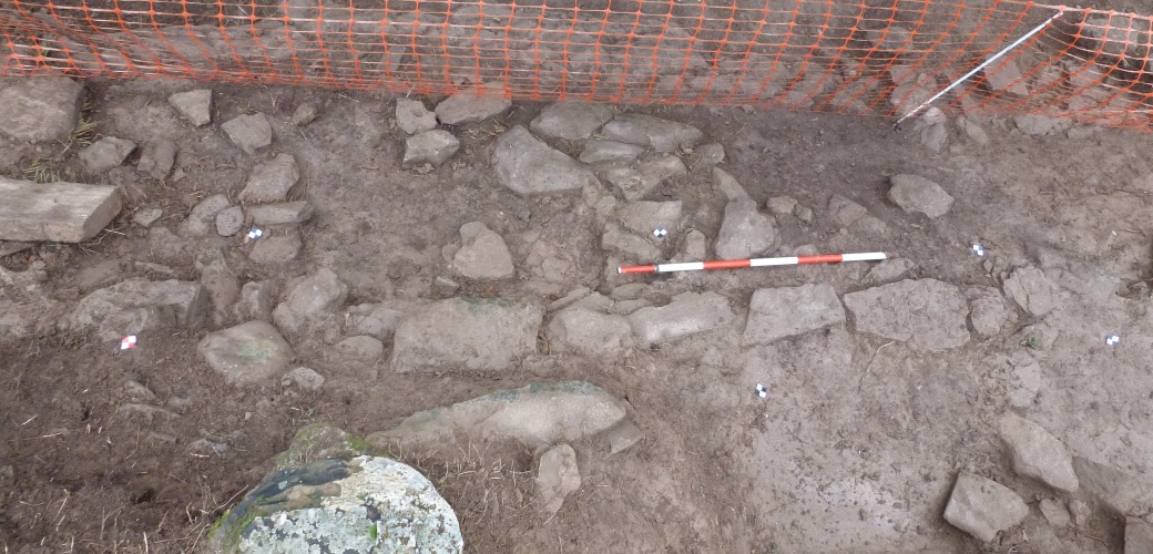
Surveys 20 to 23 had a common goal, which was to locate the city wall on the south side of the settlement.
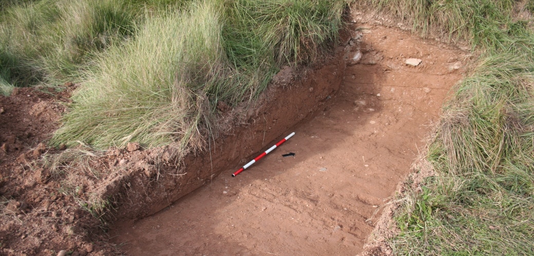
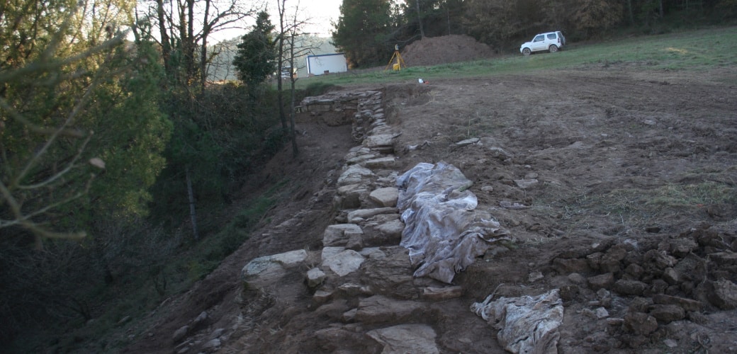
Survey 20: both the geophysical survey undertaken in 2010 and the electrical tomography at the end of 2014 indicated the presence of a stretch of city wall at this point. The work made it possible to locate the defensive structure of which only one level of stones has survived.
Survey 21: no remains of archaeological interest were found at this point. The stratigraphy seemed to respond to farm work in the area.
Survey 22: surface observation of two walls at this point, plus the marked difference in height, suggested that the city wall might be found here. The work showed that they were terraced vineyards from a more recent date.
Survey 23: surface observation of a wall at this point, plus the marked difference in height, suggested that the city wall might be found here. The work showed that they were terraced vineyards.
[left] Survey 20. Section of Late Roman Republican city wall. Survey 23: View of the test trench at the end of the excavation
Decembre 2014.
Survey 23: View of the test trench at the end of the excavation
Desembre 2014.
Survey 21: View of the test trench at the end of the excavation
Decembre 2014.
Location of the different surfaces intervened
The stretch of city wall located in survey 20 can be seen. Decembre 2014.
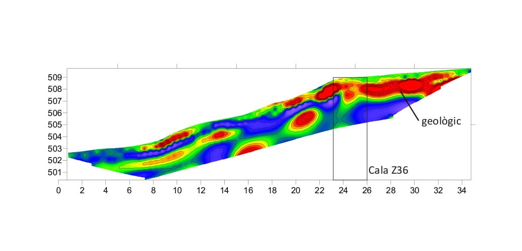
Electrical tomography (data acquisition by GS Ingeniería)
In red: rocky elements that could be bedrock or anthropic built elements. Decembre 2014.
![[left]. Photogrammetric study at the end of the 2014 season. [right] Location of various excavated structures](https://www.puigciutat.com/wp-content/uploads/2016/02/FOTOGRAMETRIA.png)
![[left]. Photogrammetric study and [right] drawing of the excavations at the end of the 2014 season](https://www.puigciutat.com/wp-content/uploads/2015/02/supi_19_fotogr.jpg)
![[left] Survey 20. Section of Late Roman Republican city wall. Survey 23: View of the test trench at the end of the excavation](https://www.puigciutat.com/wp-content/uploads/2015/02/26_39_sm.png)